


Oct 27, 2009
The Green Watch
From the project's website
The project Green Watch/Citypulse aims at multiplying by 1000 the number of environmental sensors in the city, while encouraging people’s implication in measuring environmental indices, thus associating them directly to building a sustainable city.
The green watch comprizes a watch and two environmental sensors (ozone, noise). Data are regularly broadcasted via a mobile phone to an open platform called Citypulse which receives, stores and makes measure data available and anonymous. Data can then be used freely in order to be shown on maps, used in models.

30 prototypes of the green watch was tested in May 2009 by residents of the 2nd arrondissement of Paris (Digital District) and also during Futur en Seine, by highschool students of Montreuil (Maison Populaire), by researchers in the Cité des Sciences et de l’Industrie and by visitors of the wikiplaza, place de la Bastille.


17:20 | Permalink | Comments (0) | Tags: participative ecoloogy, positive technology, locative media, openspime
Jul 23, 2008
Web GIS in practice VI: a demo "playlist" of geo-mashups for public health neogeographers
Web GIS in practice VI: a demo "playlist" of geo-mashups for public health neogeographers.
Int J Health Geogr. 2008 Jul 18;7(1):38
Authors: Kamel Boulos MN, Scotch M, Cheung KH, Burden D
ABSTRACT: 'Mashup' was originally used to describe the mixing together of musical tracks to create a new piece of music. The term now refers to Web sites or services that weave data from different sources into a new data source or service. Using a musical metaphor that builds on the origin of the word 'mashup', this paper presents a demonstration "playlist" of four geo-mashup vignettes that make use of a range of Web 2.0, Semantic Web, and 3-D Internet methods, with outputs/end-user interfaces spanning the flat Web (two-dimensional -- 2-D maps), a three-dimensional -- 3-D mirror world (Google Earth) and a 3-D virtual world (Second Life (R)). The four geo-mashup "songs" in this "playlist" are: 'Web 2.0 and GIS (Geographic Information Systems) for infectious disease surveillance', 'Web 2.0 and GIS for molecular epidemiology', 'Semantic Web for GIS mashup', and 'From Yahoo! Pipes to 3-D, avatar-inhabited geo-mashups'. It is hoped that this showcase of examples and ideas, and the pointers we are providing to the many online tools that are freely available today for creating, sharing and reusing geo-mashups with minimal or no coding, will ultimately spark the imagination of many public health practitioners and stimulate them to start exploring the use of these methods and tools in their day-to-day practice. The paper also discusses how today's Web is rapidly evolving into a much more intensely immersive, mixed-reality and ubiquitous socio-experiential Metaverse that is heavily interconnected through various kinds of user-created mashups.
08:46 Posted in Information visualization, Locative media, Social Media | Permalink | Comments (0) | Tags: locative media
Dec 08, 2007
YASMIN: Locative Media Art

Locative Media Art: Towards New Types of “Hybrid” Places for Communicating Meaning - A moderated discussion on YASMIN beginning on December 3, 2007: with Dimitris Charitos , Martin Rieser and Yanna Vogiazou.
The convergence of new mobile telecommunication networks along with geographical positioning systems and interactive graphical interfaces on mobile devices, are beginning to extend the potential of media technologies for supporting communication among mobile individuals. The aforementioned technologies allow groups of people to interact with each other, while being aware of each other’s location at all times. By introducing context awareness and by supporting multi-user communication, these ICT systems alter the patterns of information flow as well as the situation within which communication takes place, thus bringing to light new spatial structures where social interaction will occur and novel forms of cultural practices will emerge.
18:48 Posted in Cyberart, Locative media | Permalink | Comments (0) | Tags: locative media, cyberart
Dec 04, 2007
Google Maps for mobile
08:24 Posted in Locative media | Permalink | Comments (0) | Tags: locative media
Sep 27, 2007
Concrete Dialogues
Re-blogged from Networked Media
|
|

23:38 | Permalink | Comments (0) | Tags: locative media
Sep 09, 2007
Flight Simulator Mode in Google Earth 4.2
the new version of Google Earth includes a hidden Flight Simulator
Ubikwitus has posted today a list of tips to make your flying better:

22:20 Posted in Locative media | Permalink | Comments (0) | Tags: locative media
Jul 17, 2007
Antinormalizer
Via Smart Mobs
Brett Stalbaum and Derek Lomas from UC San Diego have developed Antinormalizer, a location media program that provides a creative approach of the relationship between people and their cell phones.
From Smart Mobs:
“What’s Antinormalizer?” you’ll ask. It’s basically a “hot spots” or location media program. A GPS system is aware of the mobile owner’s location and triggers an audio file to be played at that particular location. Derek scripted a number of activities delivered by these audios for people to perform with the goal of changing the “social lubrication” in a certain area, modify the normal social script in order to initiate interesting behaviors.
With Antinormalizer people play a game: instead of doing the normal stuff (like picking up the phone and simply talking to the other person), people are told to do something “outrageous,” so out of the ordinary, while their friends are taking pictures of that abnormal behavior. The best picture wins the game. The range of the abnormal behaviors can vary from reading your book while laid down on a parking spot, to playing some jungle rhythms as loud as you can, using paint bucket bottoms. If you don’t find that challenging enough, you can always clime a ten foot statue in the campus or talk to your friend across the street while you’re both sitting in a trashcan.
00:20 Posted in Locative media | Permalink | Comments (0) | Tags: locative media
Jul 03, 2007
Dislocate 07
Re-blogged from Networked Performance

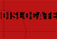
Dislocate 07: ART, TECHNOLOGY, LOCALITY - Exhibition, Symposium and Workshop series :: 24th July - 5th August :: Tokyo and Yokohama - Ginza Art Laboratory (Wednesday - Sunday 3-8pm); Koiwa Project Space (Tuesday - Sunday 2-7pm); ZAIM 28th & 29th July 11am-4pm - Symposium and Workshops; Opening Event Koiwa Project Space 24th July 7pm; Performance Event ZAIM 29th July 6pm. All Events are Free.
The city is no longer built of concrete, a static posture no longer endures. Our surroundings have become a malleable space which can be warped, spliced and expanded at will. We no longer stand in one place alone, a mass convergence of coordinates is taking place beneath our feet. As we traverse these points of perpetual motion we are enclosed by structures of elsewhere, met with the sliding walls of other places which lead us through a never ending maze. Shrouded in alternative layers of space, we escape to another confinement through the mesh of new media.
As our presence is extended by the veins of technology our sense of space is transformed, our nervous system stems through endless reaches of universal skin. Our eyes see through a thousand windows, each with a different view, a collision of a multitude of global sounds meets our ears, our fingers pass beyond tiers of materiality.
But can we see what is before us? Are we listening to the resonance of our surroundings? Can we feel the texture of this place?
Engaged in distant or imaginary space, we flick through the channels with our remote control and choose when to plug in when to switch off. But as we are absorbed by these electronic pulses are we disappearing from the here and now?
Personal technologies offer a kaleidoscopic sensation of a multi-layered existence, but perhaps may also provide a microscope by which to examine the place which we are in at this moment.
22:13 | Permalink | Comments (0) | Tags: locative media
Jun 07, 2007
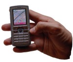
iMapFan: a GPS Map Chat
|

23:29 Posted in Locative media | Permalink | Comments (0) | Tags: locative media
May 25, 2007
Electronic Lens
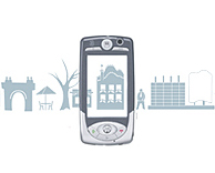
The Electronic Lens explores and creates new paradigms of civic ubiquitous networking with mobile technologies. We think of Electronic Lens as something of a viewfinder. Using a motion that is already familiar (think point and shoot camera phones), the citizen can use the eLens to gather information about physical objects and places.
The eLens matches electronic information with the physical environment in an innovative way. For example, eLens users can post lasting messages in physical locations, tag buildings and places, or create social networks based on interest and social affinities. eLens interactions combine the physical environment with formal and institutional information and the annotations from users' personal experiences.
Ultimately the eLens enhances the value of the city for its citizens by making their environments more accessible, more culturally vibrant, more socially just. The eLens fosters communication among people and between institutions; as a result citizens are now better able to navigate the social, institutional and physical urban space.
13:44 Posted in Information visualization, Locative media | Permalink | Comments (0) | Tags: locative media
Apr 22, 2007
Location-Based Services for Everyman
Korean entrepreneurs are developing location-based services that are designed for people who actually live in an area:
Deliverymen from DHL and FedEx around the world keep records of their courier services in company-provided PDAs. From next month, South Korean laundry stores could keep records of laundry orders and delivery through the mobile Web by using mobile phonesSK Telecom, which is trying hard to find new business models in the lack of new voice users, says it has also developed similar services for other industries. Insurance salespeople, construction engineers and utility company service forces could all use cell phones instead of relying on specially-designed PDAs to get access to corporate Intranet to process customer data while they are on the go. SK hopes the new handsets will help Korean companies to take advantage of the country’s wireless broadband networks to free up their employees from their desks.
Full post at BusinessWeek Asia Online

22:39 Posted in Locative media | Permalink | Comments (0) | Tags: locative media
Jan 22, 2007
Location-tracker in Second Life
Via 3DPoint
SLStats comes in the form of a wristwatch, available in Hill Valley Square [in SL] in the Huin sim. Once you register with the service in-world, the watch “watches” where you go, tracking your location as you move around the world, as well as which other avatars you come into contact with. The information is used on the SLStats site to rank most popular regions (among SLStats users, of course), and to track how much time you’ve spent in-world, which you can view at a link like this one, which tracks Glitchy: http://slstats.com/users/view/Glitchy+Gumshoe.

00:23 Posted in Locative media, Virtual worlds | Permalink | Comments (0) | Tags: locative media, virtual reality
Dec 28, 2006
Tokyo Ubiquitous Network Project
Via 3DPoint

The Tokyo Ubiquitous Network Project seeks to outfit Tokyo’s high-end shopping district, the Ginza, with 10,000 RFID tags and other digital beacons. The project, led by Ken Sakamura, a professor at the University of Tokyo, will bring location-based information to people carrying prototype readers developed for the trial.
From the PC Advisor article:
“Bringing the terminal close to an RFID tag on a street lamp will pinpoint the user’s location and the system will be able to guide them to the nearest railway station, while walking past a radio beacon in front of a shop might bring up details of current special offers or a menu for a restaurant.”
20:11 Posted in Locative media, Social Media | Permalink | Comments (0) | Tags: social networks, locative media
Dec 03, 2006
Geovirtual reality for sharing information
From Emerging Technology Trends
Engineers and computer scientists at West Virginia University's GeoVirtual Laboratory (GVL) have developed what they called the VRGIS solution - short for 'virtual reality geographic information systems.' The VRGIS project combines several technologies, such as virtual reality (VR), location based services (LBS), and geographic information systems (GIS) with 'the power of the Internet to provide people with a portal to dynamically share information in a revolutionary new way.'
23:04 Posted in Locative media, Virtual worlds | Permalink | Comments (0) | Tags: virtual reality, locative media
Connecting people by their real-world location
Re-blogged from TechCrunch
Instant messaging programs connect people across the Internet. Newer programs like RadiusIM and Meetro, connect people by their real-world location. RadiusIM is an AJAX application, while Meetro is a downloadable client. Both allow you to fill out your location and profile as a way to meet new people in your area, or even another country. Unlike the other developments in chat, location based IM hasn’t seen heavy adoption on other platforms, which continue to connect people based on a user generated buddy list.
.12:00 Posted in Locative media | Permalink | Comments (0) | Tags: locative media
Nov 07, 2006
SLAM - Mobile social networking from Microsoft Research
Via LADS
SLAM is a mobile based social networking application deveoped by Microsoft Research’s Community Technologies Group, which enables lightweight, group-centric real-time communication, photo-sharing and location awareness.

From LADS:
From the user perspective, “Slam” means a group of people with whom you can share you exchange messages and share photos easily through your mobile phone. Slam works on group level, which means that any messages sent to a Slam gets delivered to all the members in the group. To use Slam you need to install the Slam application on your Windows Mobile based devices and need a unlimited data plan. So any messages sent from your smart phone will be over HTTP instead of using SMS. If you don’t have Windows based device, you can still communicate with your Slams through SMS, since each Slam has a different phone number to enable SMS delivery.
Slam delivers a pretty impressive feature set on the smart phones. Besides exchanging messages, users can view private and public Slams, create Slam, invite people to an existing Slam, join Slams, view Slam members, view and upload photos, manage their Slams, and view unread messages. While viewing a member profile Slam also indicates if you the user has any an intersecting Slam group with you.
One of the best features Slam team is working on is to provide location information of people in your Slam group. Once group members set their privacy level to allow appropriate Slam groups to view their location information, Slam maps the location information onto a Windows Live map on your mobile. This feature is more of a proof of concept and works only on few phone including Audiovox 5600, I-Mate Sp3 and i-Mate SP5 for some of the Seattle users of Cingular/AT&T and T-Mobile.
Visit also the Microsoft Slam Team Blog
00:00 Posted in Locative media, Social Media | Permalink | Comments (0) | Tags: social networks, locative media
Oct 31, 2006
A couple of interesting links about locative media
Check out these couple of links (via LADS):
1) Tip // Location-Based social networking from NavXS

NavXS, short for Navigation Exchange Service, is a location-based social network. Think of it as an instant messaging service, like MSN or ICQ, but in addition to seeing when other users are online, you can see where they are online.
have a look to the NavXS website. The service is running in beta version, but one can sign up and try it.
there is also a blog (still under construction)
2) iPointer Platform

The iPointer™ Platform is a platform for developing location-based applications such as mobile search, GPS tracking, geotagging, geoblogging, pedestrian navigation, and targeted advertising. The platform allows users to point, click, and select points of interest such as historical buildings, restaurants, and landmarks with their cell phone or PDA and then receive location-specific multimedia content.
The iPointer includes both a client component that runs on most cell phones and PDAs and a server-based geospatial search engine. The iPointer client relies on data collected from GPS receivers such as the SiRFstarIII and a digital compass. The search engine is a hosted service that identifies a point of interest and sends back data that can be aggregated from a variety of content sources. Applications include self-guided historic tours, city guides, campus tours, and pedestrian navigation.
Find out more here
18:00 Posted in Locative media | Permalink | Comments (0) | Tags: locative media
New magazine about Locative Media launched
Re-blogged from Networked Performance
[Re: ] magazine is an international new media online magazine about locative media.
Locative Media - recently becoming more popular in Media Art discourses- has roots dating back to the dawn of history. Early myths like the Gilgamesch Epic or - more specific - Homer's Odyssee deal with issues of location and the recording of movement on earth's surface...
Developments since then include mediaeval cartography as well as the Situationists' approach to mapping a city. Nowadays Locative Media uses technology to trigger artworks in a specific physical space. The magazine features an depth interview with locative media artist Jeremy Hight about a new form of dissent utilizing smart mobs, on line community and locative media
17:25 Posted in Locative media | Permalink | Comments (0) | Tags: locative media
Aug 02, 2006
Urban Tapestries
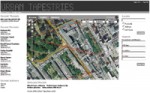
Urban Tapestries aims to enable people to become authors of the environment around them – Mass Observation for the 21st Century. Like the founders of Mass Observation in the 1930s, we are interested creating opportunities for an "anthropology of ourselves" – adopting and adapting new and emerging technologies for creating and sharing everyday knowledge and experience; building up organic, collective memories that trace and embellish different kinds of relationships across places, time and communities.
It is part of an ongoing research programme of experiments with local groups and communities called Social Tapestries.
10:23 Posted in Information visualization, Telepresence & virtual presence, Wearable & mobile | Permalink | Comments (0) | Tags: locative media