


Aug 28, 2013
Twitter reveals the happiest spots in New York
Sentiment in New York City: A High Resolution Spatial and Temporal View
Karla Z. Bertrand, Maya Bialik, Kawandeep Virdee, Andreas Gros, Yaneer Bar-Yam
http://arxiv.org/abs/1308.5010v1 (link to PDF full text)
Measuring public sentiment is a key task for researchers and policymakers alike. The explosion of available social media data allows for a more time-sensitive and geographically specific analysis than ever before. In this paper we analyze data from the micro-blogging site Twitter and generate a sentiment map of New York City. We develop a classifier specifically tuned for 140-character Twitter messages, or tweets, using key words, phrases and emoticons to determine the mood of each tweet. This method, combined with geotagging provided by users, enables us to gauge public sentiment on extremely fine-grained spatial and temporal scales. We find that public mood is generally highest in public parks and lowest at transportation hubs, and locate other areas of strong sentiment such as cemeteries, medical centers, a jail, and a sewage facility. Sentiment progressively improves with proximity to Times Square. Periodic patterns of sentiment fluctuate on both a daily and a weekly scale: more positive tweets are posted on weekends than on weekdays, with a daily peak in sentiment around midnight and a nadir between 9:00 a.m. and noon.
19:01 Posted in Locative media, Social Media | Permalink | Comments (0)
Apr 29, 2012
The SoLoMo manifesto
The SoLoMo Manifesto is a free-downloadable white paper that explores the mega-markets of social, local, and mobile as a cohesive ecosystem of marketing technologies.
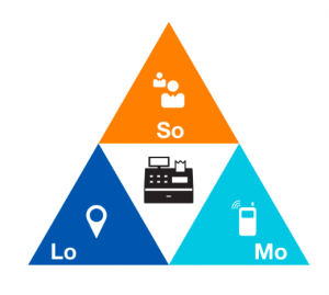
The manifesto has been produced by MomentFeed, a location-based marketing platform for the enterprise. It's an interesting reading. You can download this free whitepaper here.
13:18 Posted in Locative media, Pervasive computing | Permalink | Comments (0)
Mar 31, 2012
Everywhere I've Been: Mapping 3 Years Worth of Location Tracking
Via InfoAestetics

Co-founder of Geoloqi Aaron Parecki is showing of the core services of this mobile platform for tracking and sharing location data, in the blog post "Everywhere I've Been".
The resulting maps are generated entirely from 2.5 million unique GPS points (about 1 point per 2 to 6 seconds), which were tracked by his iPhone or Android phone for the past 3.5 years (resulting also in some interesting battery issues).
The trajectories and itineraries on the maps have been colored by year, in order to reveal how his physical footprint changes over time due to the different locations of his house.
13:09 Posted in Locative media, Self-Tracking | Permalink | Comments (0)
Mar 28, 2012
Emotizer
Emotizer is a new emotional social network that allows you to bookmark places, people, objects, dreams and thoughts and link them to the emotions you're feeling within.


19:27 Posted in Emotional computing, Locative media, Self-Tracking | Permalink | Comments (0)
Jan 17, 2011
The Google Earth Treadmill: A New Way to Explore the World
According to a report on Mashable, Panasonic’s VIERA Connect TVs, in collaboration with NordicTrack, unveiled a television at CES that lets you experience virtual trails straight from your living room.
The HDTV displays Google Maps and communicates inclinations of hills and valleys to the treadmill. The machine is also able to incline itself at the appropriate times, matching those hills every step of the way. Other real-life features include cars and people crossing your path.
Have a good (virtual) walk!
16:24 Posted in Locative media, Virtual worlds | Permalink | Comments (0)
May 27, 2009
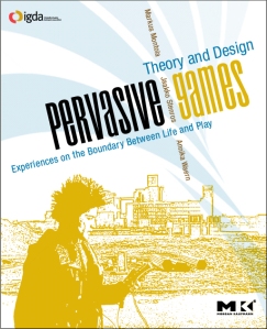
New book on Pervasive Games
| New book on Pervasive Games: “Pervasive Games: Theory and Design - Experiences on the Boundary between Life and Play ” by Markus Montola, Jaakko Stenros and Annika Waer (editors) published by Morgan Kauffman |
“Quickly emerging from the fast-paced growth of mobile communications and wireless technologies, pervasive games provide a worldwide network of potential play spaces. Now games can be designed to be played in public spaces like streets, conferences, museums and other non-traditional game venues – and game designers need to understand the world as a medium—both its challenges and its advantages.
This book shows how to change the face of play—who plays, when and where they play and what that play means to all involved. The authors explore aspects of pervasive games that concern game designers: what makes these games compelling, what makes them possible today, how they are made and by whom. For theorists, it provides a solidtheoretical, philosophical and aesthetic grounding of their designs. Pervasive Games covers everything from theory and design to history and marketing. Designers will find 13 detailed game descriptions, a wealth of design theory, examples from dozens of games and a thorough discussion of past inspirations—directly from the game designers themselves.“
17:54 Posted in Locative media, Pervasive computing | Permalink | Comments (0) | Tags: pervasive games
Jan 26, 2009
WideNoise
One of the thing I hate most about living in a big city is the noise from road traffic. The most disturbing types of noise for me are (in order of irritation):
1) motorbike noise
2) emergency noise
3) noise from construction/demolition activites

In addition of being very unpleasant and harmful for our hearing system, noise can have negative impact on general health. For example, Swedish researchers have found that the exposure to even relatively low levels of noise may increase increase the risk of cardiovascular disease, heart attack and high blood pressure.
Even though we are accustomed to this background noise, we should at least be aware of how dangerous it is. Guys at WideTag have developed an iPhone/iPod touch application - WideNoise - that allows to monitor the noise level in the space surrounding the user. The noise data are collected and displayed on an online map. I think that this application could be also used by employers to monitor workplace noise.
Good job guys!


11:36 Posted in Information visualization, Locative media, Wearable & mobile | Permalink | Comments (0) | Tags: widenoise
Jul 23, 2008
Web GIS in practice VI: a demo "playlist" of geo-mashups for public health neogeographers
Web GIS in practice VI: a demo "playlist" of geo-mashups for public health neogeographers.
Int J Health Geogr. 2008 Jul 18;7(1):38
Authors: Kamel Boulos MN, Scotch M, Cheung KH, Burden D
ABSTRACT: 'Mashup' was originally used to describe the mixing together of musical tracks to create a new piece of music. The term now refers to Web sites or services that weave data from different sources into a new data source or service. Using a musical metaphor that builds on the origin of the word 'mashup', this paper presents a demonstration "playlist" of four geo-mashup vignettes that make use of a range of Web 2.0, Semantic Web, and 3-D Internet methods, with outputs/end-user interfaces spanning the flat Web (two-dimensional -- 2-D maps), a three-dimensional -- 3-D mirror world (Google Earth) and a 3-D virtual world (Second Life (R)). The four geo-mashup "songs" in this "playlist" are: 'Web 2.0 and GIS (Geographic Information Systems) for infectious disease surveillance', 'Web 2.0 and GIS for molecular epidemiology', 'Semantic Web for GIS mashup', and 'From Yahoo! Pipes to 3-D, avatar-inhabited geo-mashups'. It is hoped that this showcase of examples and ideas, and the pointers we are providing to the many online tools that are freely available today for creating, sharing and reusing geo-mashups with minimal or no coding, will ultimately spark the imagination of many public health practitioners and stimulate them to start exploring the use of these methods and tools in their day-to-day practice. The paper also discusses how today's Web is rapidly evolving into a much more intensely immersive, mixed-reality and ubiquitous socio-experiential Metaverse that is heavily interconnected through various kinds of user-created mashups.
08:46 Posted in Information visualization, Locative media, Social Media | Permalink | Comments (0) | Tags: locative media
Jan 05, 2008
Portable navigation on mobiles set to take off
EE Times Europe (01/03/2008 8:30 AM EST)
LONDON — Sales of portable navigation devices are set to increase ten-fold over the next eight years, with the huge take-up coming from the the GPS functionality being embedded into mobile phones, according to Telematics Research Group (TRG).
While Garmin and TomTom are predicted to remain global market leaders for portable navigation devices, mobile phone makers such as Nokia, Motorola, LG and Samsung are expected to show the way in the near future, the Minneapolis based market research group suggests in a report on the sector.
TRG sees the worldwide portable navigation market growing from 50 million units in 2007 to more than 500 million units in 2015.
It suggests the change in market leadership is partly due to wireless connectivity opening up new applications and services by bringing together accurate location-based data with advanced POI data including pricing, inventory and user-generated content such as ratings of local businesses.
TRG estimates 30 million dedicated Personal Navigation Devices (PNDs) were sold last year and about 20 million navigation-enabled mobile phones. It estimates that navigation-enabled mobile phones will start outselling dedicated PNDs next year, with the combined segments reaching annual sales of more than 220 million by the end of 2012.
The market researchers suggest that by 2015, Nokia could be selling 180 million devices with GPS capability, followed by Samsung and Motorola (both 70 million), LG (60 million), and TomTom and Garmin both 25 million.
Corresponding figures for last year are said to be 9 million units sold by TomTom, 8 million by Garmin, 7 million by Mitac, 5 million by Nokia and 4 million by Mio/Navman.
"In the years to come navigation-enabled mobile phones will be used for auto navigation, pedestrian navigation and many other types of location-based services," says Egil Juliussen, principal analyst for TRG. "This opens up a new world of services and capabilities".
Recent acquisitions by TomTom and Nokia point the way toward the coming battle for the GPS consumer, according to Juliussen.
"Required for success in the GPS market of the future will be connectivity, inexpensive maps and rich point-of-interest content addresses alone will not be enough", he adds.
Garmin and TomTom are adding connectivity to their devices, he notes, and mobile phone makers are adding maps. "A large volume market for inexpensive, dedicated navigation devices will live on past 2008," Juliussen says, but survival for TomTom and Garmin may mean finding a way to compete for smartphone users.
17:14 Posted in Locative media, Wearable & mobile | Permalink | Comments (0) | Tags: mobile, wearable
Dec 08, 2007
YASMIN: Locative Media Art

Locative Media Art: Towards New Types of “Hybrid” Places for Communicating Meaning - A moderated discussion on YASMIN beginning on December 3, 2007: with Dimitris Charitos , Martin Rieser and Yanna Vogiazou.
The convergence of new mobile telecommunication networks along with geographical positioning systems and interactive graphical interfaces on mobile devices, are beginning to extend the potential of media technologies for supporting communication among mobile individuals. The aforementioned technologies allow groups of people to interact with each other, while being aware of each other’s location at all times. By introducing context awareness and by supporting multi-user communication, these ICT systems alter the patterns of information flow as well as the situation within which communication takes place, thus bringing to light new spatial structures where social interaction will occur and novel forms of cultural practices will emerge.
18:48 Posted in Cyberart, Locative media | Permalink | Comments (0) | Tags: locative media, cyberart
Dec 04, 2007
Google Maps for mobile
08:24 Posted in Locative media | Permalink | Comments (0) | Tags: locative media
Sep 09, 2007
Flight Simulator Mode in Google Earth 4.2
the new version of Google Earth includes a hidden Flight Simulator
Ubikwitus has posted today a list of tips to make your flying better:

22:20 Posted in Locative media | Permalink | Comments (0) | Tags: locative media
Jul 17, 2007
Antinormalizer
Via Smart Mobs
Brett Stalbaum and Derek Lomas from UC San Diego have developed Antinormalizer, a location media program that provides a creative approach of the relationship between people and their cell phones.
From Smart Mobs:
“What’s Antinormalizer?” you’ll ask. It’s basically a “hot spots” or location media program. A GPS system is aware of the mobile owner’s location and triggers an audio file to be played at that particular location. Derek scripted a number of activities delivered by these audios for people to perform with the goal of changing the “social lubrication” in a certain area, modify the normal social script in order to initiate interesting behaviors.
With Antinormalizer people play a game: instead of doing the normal stuff (like picking up the phone and simply talking to the other person), people are told to do something “outrageous,” so out of the ordinary, while their friends are taking pictures of that abnormal behavior. The best picture wins the game. The range of the abnormal behaviors can vary from reading your book while laid down on a parking spot, to playing some jungle rhythms as loud as you can, using paint bucket bottoms. If you don’t find that challenging enough, you can always clime a ten foot statue in the campus or talk to your friend across the street while you’re both sitting in a trashcan.
00:20 Posted in Locative media | Permalink | Comments (0) | Tags: locative media
Jun 07, 2007
iMapFan: a GPS Map Chat
|

23:29 Posted in Locative media | Permalink | Comments (0) | Tags: locative media
May 25, 2007
Electronic Lens
The Electronic Lens explores and creates new paradigms of civic ubiquitous networking with mobile technologies. We think of Electronic Lens as something of a viewfinder. Using a motion that is already familiar (think point and shoot camera phones), the citizen can use the eLens to gather information about physical objects and places.
The eLens matches electronic information with the physical environment in an innovative way. For example, eLens users can post lasting messages in physical locations, tag buildings and places, or create social networks based on interest and social affinities. eLens interactions combine the physical environment with formal and institutional information and the annotations from users' personal experiences.
Ultimately the eLens enhances the value of the city for its citizens by making their environments more accessible, more culturally vibrant, more socially just. The eLens fosters communication among people and between institutions; as a result citizens are now better able to navigate the social, institutional and physical urban space.
13:44 Posted in Information visualization, Locative media | Permalink | Comments (0) | Tags: locative media
Apr 22, 2007
Location-Based Services for Everyman
Korean entrepreneurs are developing location-based services that are designed for people who actually live in an area:
Deliverymen from DHL and FedEx around the world keep records of their courier services in company-provided PDAs. From next month, South Korean laundry stores could keep records of laundry orders and delivery through the mobile Web by using mobile phonesSK Telecom, which is trying hard to find new business models in the lack of new voice users, says it has also developed similar services for other industries. Insurance salespeople, construction engineers and utility company service forces could all use cell phones instead of relying on specially-designed PDAs to get access to corporate Intranet to process customer data while they are on the go. SK hopes the new handsets will help Korean companies to take advantage of the country’s wireless broadband networks to free up their employees from their desks.
Full post at BusinessWeek Asia Online

22:39 Posted in Locative media | Permalink | Comments (0) | Tags: locative media
Jan 22, 2007
Location-tracker in Second Life
Via 3DPoint
SLStats comes in the form of a wristwatch, available in Hill Valley Square [in SL] in the Huin sim. Once you register with the service in-world, the watch “watches” where you go, tracking your location as you move around the world, as well as which other avatars you come into contact with. The information is used on the SLStats site to rank most popular regions (among SLStats users, of course), and to track how much time you’ve spent in-world, which you can view at a link like this one, which tracks Glitchy: http://slstats.com/users/view/Glitchy+Gumshoe.

00:23 Posted in Locative media, Virtual worlds | Permalink | Comments (0) | Tags: locative media, virtual reality
Dec 28, 2006
Tokyo Ubiquitous Network Project
Via 3DPoint

The Tokyo Ubiquitous Network Project seeks to outfit Tokyo’s high-end shopping district, the Ginza, with 10,000 RFID tags and other digital beacons. The project, led by Ken Sakamura, a professor at the University of Tokyo, will bring location-based information to people carrying prototype readers developed for the trial.
From the PC Advisor article:
“Bringing the terminal close to an RFID tag on a street lamp will pinpoint the user’s location and the system will be able to guide them to the nearest railway station, while walking past a radio beacon in front of a shop might bring up details of current special offers or a menu for a restaurant.”
20:11 Posted in Locative media, Social Media | Permalink | Comments (0) | Tags: social networks, locative media
Dec 03, 2006
Geovirtual reality for sharing information
From Emerging Technology Trends
Engineers and computer scientists at West Virginia University's GeoVirtual Laboratory (GVL) have developed what they called the VRGIS solution - short for 'virtual reality geographic information systems.' The VRGIS project combines several technologies, such as virtual reality (VR), location based services (LBS), and geographic information systems (GIS) with 'the power of the Internet to provide people with a portal to dynamically share information in a revolutionary new way.'
23:04 Posted in Locative media, Virtual worlds | Permalink | Comments (0) | Tags: virtual reality, locative media
Connecting people by their real-world location
Re-blogged from TechCrunch
Instant messaging programs connect people across the Internet. Newer programs like RadiusIM and Meetro, connect people by their real-world location. RadiusIM is an AJAX application, while Meetro is a downloadable client. Both allow you to fill out your location and profile as a way to meet new people in your area, or even another country. Unlike the other developments in chat, location based IM hasn’t seen heavy adoption on other platforms, which continue to connect people based on a user generated buddy list.
.12:00 Posted in Locative media | Permalink | Comments (0) | Tags: locative media